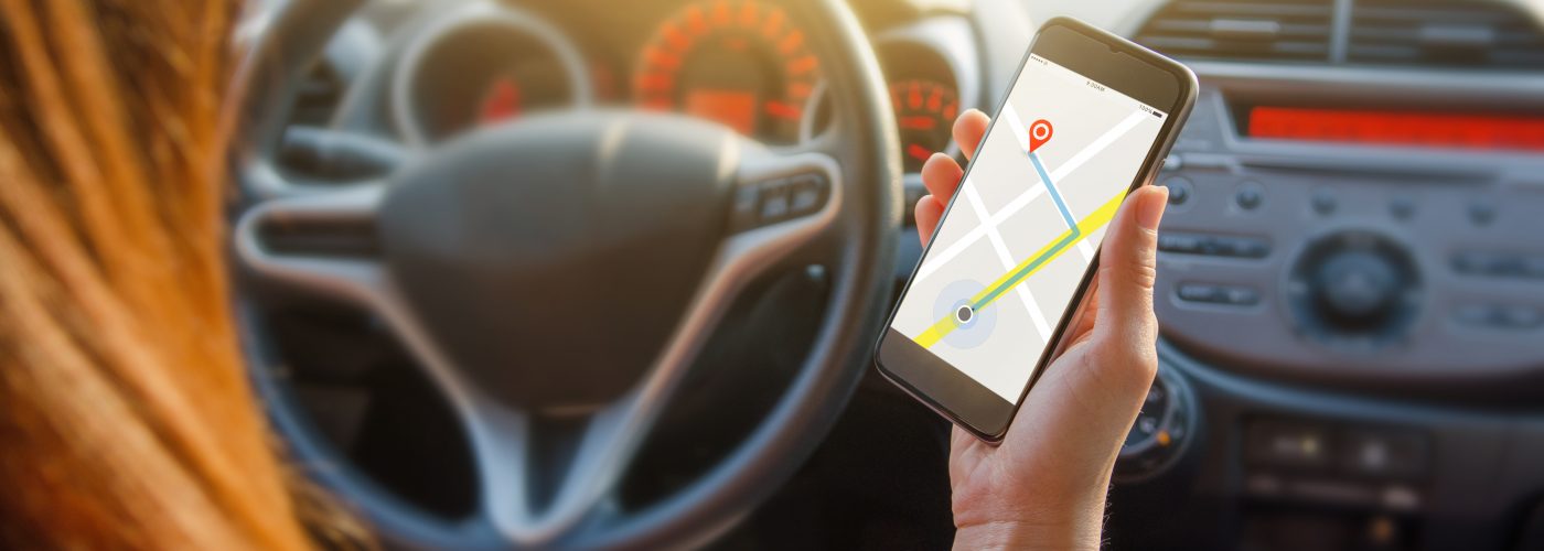
While navigation is one of the most important uses travelers have for their smartphones, how often do you think about exactly how a phone knows where you are and where you’re going? You might not know that in addition to connecting to cellular towers, your phone is constantly tracking GPS signals from satellites circling the planet—and that you can use your phone GPS without data for more purposes than you might expect.
If you’ve ever tried to navigate in a place where your phone has weak or no celluar service, you probably wished you could take advantage of offline phone GPS. Fortunately, you can: GPS signals are raining down around us at all times, and your phone can connect to them without any real reliance on your cellular company, impact on your data plan, or dependence on the phone mode you are in. These signals are free for all of us to use, so long as we have the right apps and a device with which to connect.
In fact, you can even use an older, retired phone as a GPS unit, so long as the apps will still run on the operating system. Then, once you get back to civilization, your regular smartphone will still be fully charged and ready to go.
How Accurate Is My Phone GPS Without Data?
Most of the apps I have used measure GPS coordinates to tenths of a second, which is accurate within four to 11 meters, depending on where on the planet you are plotting (accuracy improves as you move toward the poles).
If that isn’t close enough, within the next year technology is coming that will make some phones accurate to within one foot.
You Don’t Have to Be Offline to Use a Phone as GPS
Many of the most popular uses for GPS are for folks who are off the grid without access to Wi-Fi or cellular connections, but the technology’s usefulness is not limited to the backcountry by any means. First, we all know that cell coverage is hardly ubiquitous even in developed areas; heck, my kid’s central New Jersey soccer practice field shows “no service” so often that some parents drive a mile down the road during practice to connect.
Another benefit is preserving battery life; GPS uses are particularly beneficial when you are doing things in areas where cellular service is available but poor, which causes your phone to burn up battery life trying to connect. Using offline phone GPS can also help you conserve data. This is useful when traveling abroad, where data plans are often costly and limited.
Finally, many location-based apps gobble up data voraciously. Your phone’s GPS tracking allows you to use them in offline mode, incurring no data penalty so long as you preload maps and information while connected to Wi-Fi.
Certainly, your cellphone can do more without a cell connection than you might think; here are five of the best.
Track Your Flight in Real Time
Let’s start with my favorite way to use phone GPS without data: to track the flight I’m on in real time. There are a few apps that do this, but I use Flyover Country, created by University of Minnesota researchers and funded by the National Science Foundation.
The app offers options to view road maps, terrain maps, and satellite maps, including information on geology, underwater core samples, mammal and dinosaur fossils, and landscape features for various destinations as you pass over them in flight.
To use the app you need to input and preload all the data along the route while still on a Wi-Fi or cell connection. Then, once you go into airplane mode, all that information is available as you fly, along with your ground speed and altitude.
You’ll need a window seat for this to work well; in fact, on some flights I have found that I had to have the phone almost against the window to obtain and hold a reliable GPS signal.
Go Backcountry Hiking
Smartphones are becoming go-to tools for many hardcore backcountry travelers, who can spend days or even months out of range of cellular signals. Many find phones more space- and weight-efficient than dedicated GPS units, particularly since phones can take photos, too.
This excellent how-to guide makes a compelling case for a smartphone as your go-to GPS tool. It includes some very good battery life management tips, noting that some phones can last five to 10 days without a charge with careful use.
A few of the best backcountry navigation apps include Gaia GPS, AllTrails, iPhiGeNie, and ViewRanger.
Track Your Fitness
A booming number of fitness applications work with offline GPS, including MapMyRide, Strava, MapMyRun, Runkeeper, and MapMyFitness. For most of these, using your phone GPS without data will allow you to track your run, walk, hike, or other outing offline. While you need a connection to take advantage of some of the apps’ features, using them on GPS-only mode preserves on battery life and data usage, which can be a helpful upside when you are tracking long bike rides or runs.
Fitness Armband for Your Phone
The most quintessential time to save data and money is during your workout- complete with a robust armband of course.
Note Your Exact Location
There are all kinds of ways this can be useful, such as saving your spot in an airport parking lot or sharing your location with someone else to facilitate a meetup. I know folks who have used GPS coordinates on their phones to mark and/or share things like trailheads, campsites, turn-offs for dirt roads, fishing spots, waterfalls, and abandoned ruins.
The free My GPS Coordinates app (available for iOS and Android) has functions to email or text your coordinnates directly from the main screen, and even shows the accuracy of the GPS signal (it tracks my office desk within 16 to 33 feet depending on signal access).
To share locations you obviously need connectivity, but you can log them using GPS and then share or recall them later.
Use Mapping Apps Offline
Finally, there are heaps of full-featured offline mapping applications, including the ubiquitous Google Maps and Apple Maps. Many of these are unfortunately somewhat limited when it comes to GPS-only navigation; Google Maps, for example, allows you to pre-download a 50-square-kilometer map for temporary offline use, which will help in some situations but isn’t much use on a longer road trip. To find alternatives, see 10 Best GPS App and Navigation App Options for Android and 4 Best Offline Maps Apps for iOS, Android, and Windows Phone.
Did we miss any other great ways to use your phone GPS without data? Let us know in the comments.
Cell Phone Car Mount
Make navigation a little safer with a car mount stand- adaptable to almost all smartphone sizes.
More from SmarterTravel:
- 8 Helpful Travel Apps You Can Use without Wi-Fi
- 8 Best Health Apps for Travelers
- The 27 Best Apps for Solo Travelers
Ed Hewitt is a seasoned globetrotter who brings you a biweekly glimpse into the latest travel news, views, and trends—and how they could affect your travel plans.
We hand-pick everything we recommend and select items through testing and reviews. Some products are sent to us free of charge with no incentive to offer a favorable review. We offer our unbiased opinions and do not accept compensation to review products. All items are in stock and prices are accurate at the time of publication. If you buy something through our links, we may earn a commission.
Related
Top Fares From
Today's Top Travel Deals
Brought to you by ShermansTravel
France: 8-Night Paris, Avignon & Nice...
Infinity Worldwide Vacations
 vacation
$2880+
Poconos: 3 Nts in Garden of...
ResortsAndLodges.com
 hotel
$305+
7-Nt Canada & New England Cruise,...
Princess Cruises
 cruise
$839+
